A tool for reducing landslide risk through land-use planning GNS Science has produced guidance for planners to reduce landslide risk through land-use planning. The guidance strongly emphasises the need to incorporate landslide risk early in the land-use planning decision-making process to avoid costly and potentially dangerous new developments that could pose a risk to the […]
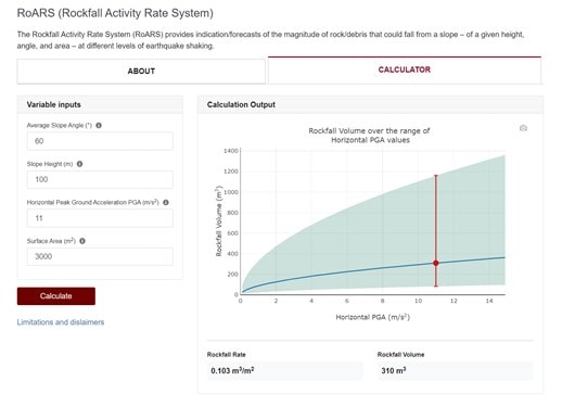
Introduction The Rockfall Activity Rate System (RoARS) provides an indication/forecast of the magnitude of rock/debris that could fall from a slope – of a given height, angle, and area – at different levels of earthquake shaking. These forecasts are derived from an empirical relationship between the volumes of rock that fell from the selected Port […]
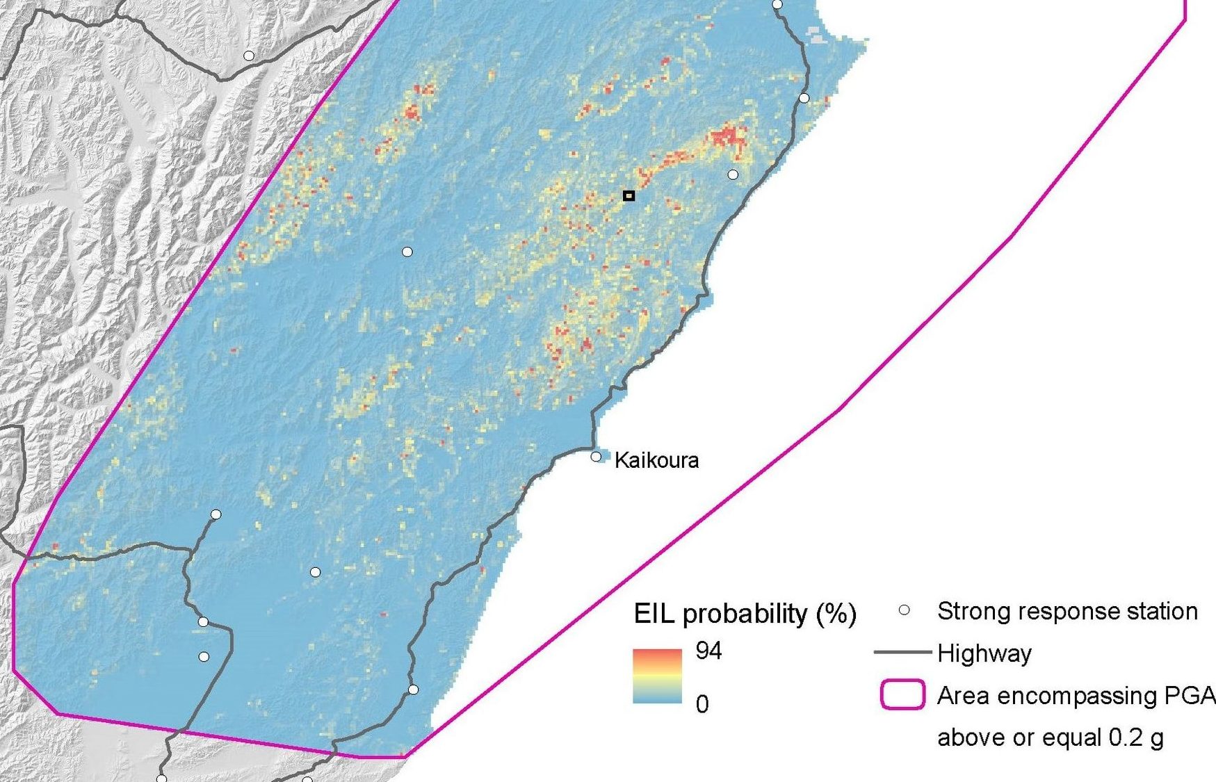
This tool provides rapid advisory information about the ‘intensity’ and likely location of landslides following a major earthquake in New Zealand. The tool produces a model of landslide probability after a significant earthquake in near-real time – approximately 7 minutes after being triggered. The tool is operational within the National Geohazard Monitoring Centre of GeoNet […]
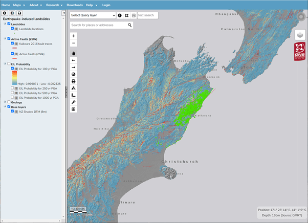
The EILD webmap (below) displays spatial data captured or derived from the project as it becomes available. Some data can be downloaded from the links provided Currently the map has: Earthquake-induced landslides (points only) generated by the M7.8 M 2016 Kaikoura Earthquake Earthquake-induced forecast (probability) maps for 100-, 250-, 500- and 1000-year return period earthquake […]