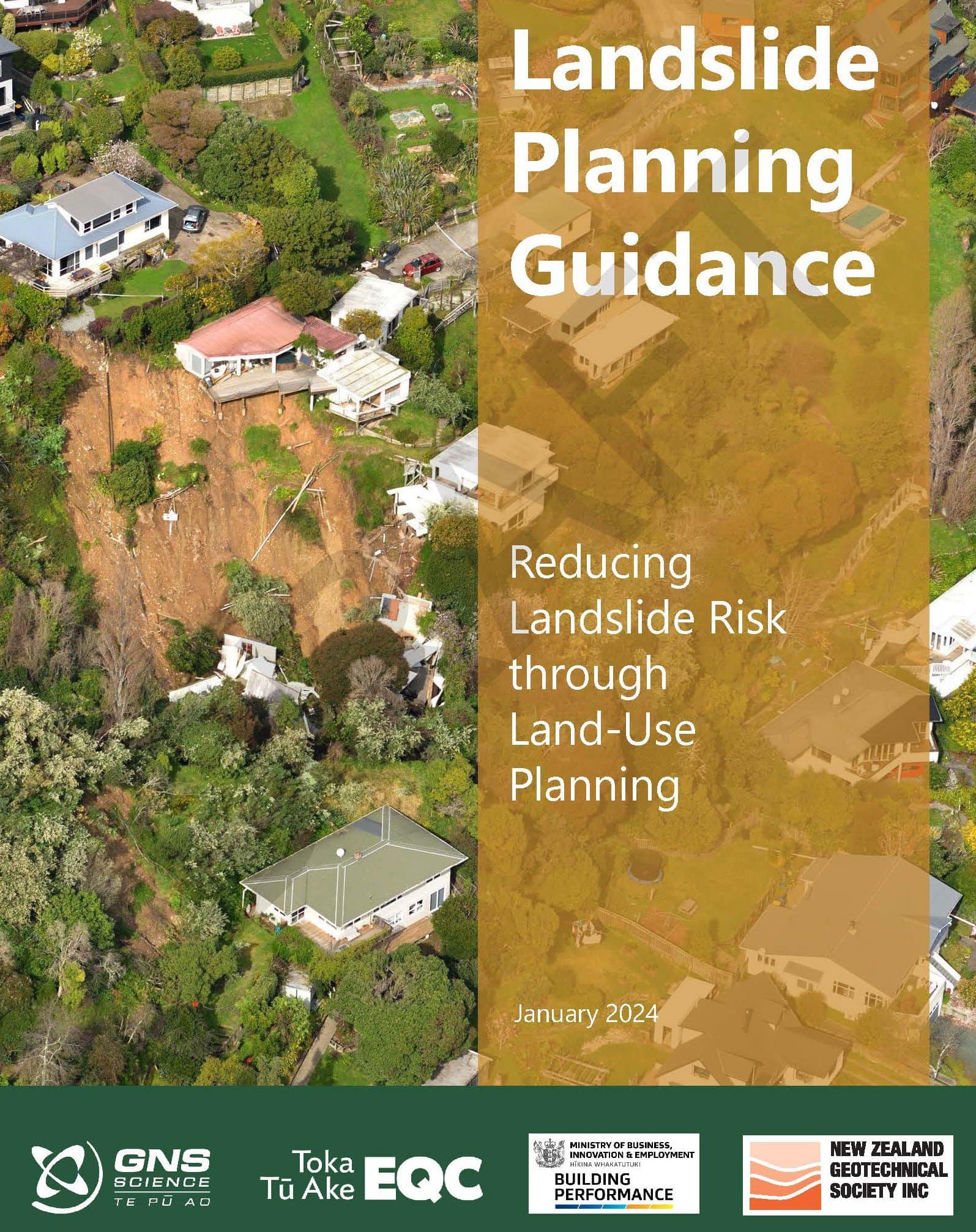
GNS Science has produced guidance for planners to reduce landslide risk through land-use planning. The guidance strongly emphasises the need to incorporate landslide risk early in the land-use planning decision-making process to avoid costly and potentially dangerous new developments that could pose a risk to the people, property and environment.
While this guidance is primarily for planning, policy and consenting roles in local government, it will be useful for infrastructure and asset managers, consultants, developers as well as professionals providing landslide susceptibility, hazard and risk advice.
At a minimum, the guidance recommends districts develop a landslide susceptibility map to better inform important decisions that determine where and how we live.
The guidance is electronic only but is formatted so it can be printed in book form. It will be updated periodically as new legislation is enacted or new research requires amendment of the guidance.
de Vilder SJ, Kelly SD, Buxton R, Allan S, Glassey PJ. 2024. Landslide Planning Guidance. Reducing landslide risk through land-use planning. Lower Hutt (NZ): GNS Science 77 p (GNS Scicence miscellaneous series; 144). doi:10.21420/R2X8-FJ49
Head Office
1 Fairway Drive,
Avalon 5010
PO Box 30-368,
Lower Hutt 5040
New Zealand