This tool provides rapid advisory information about the ‘intensity’ and likely location of landslides following a major earthquake in New Zealand. The tool produces a model of landslide probability after a significant earthquake in near-real time – approximately 7 minutes after being triggered.
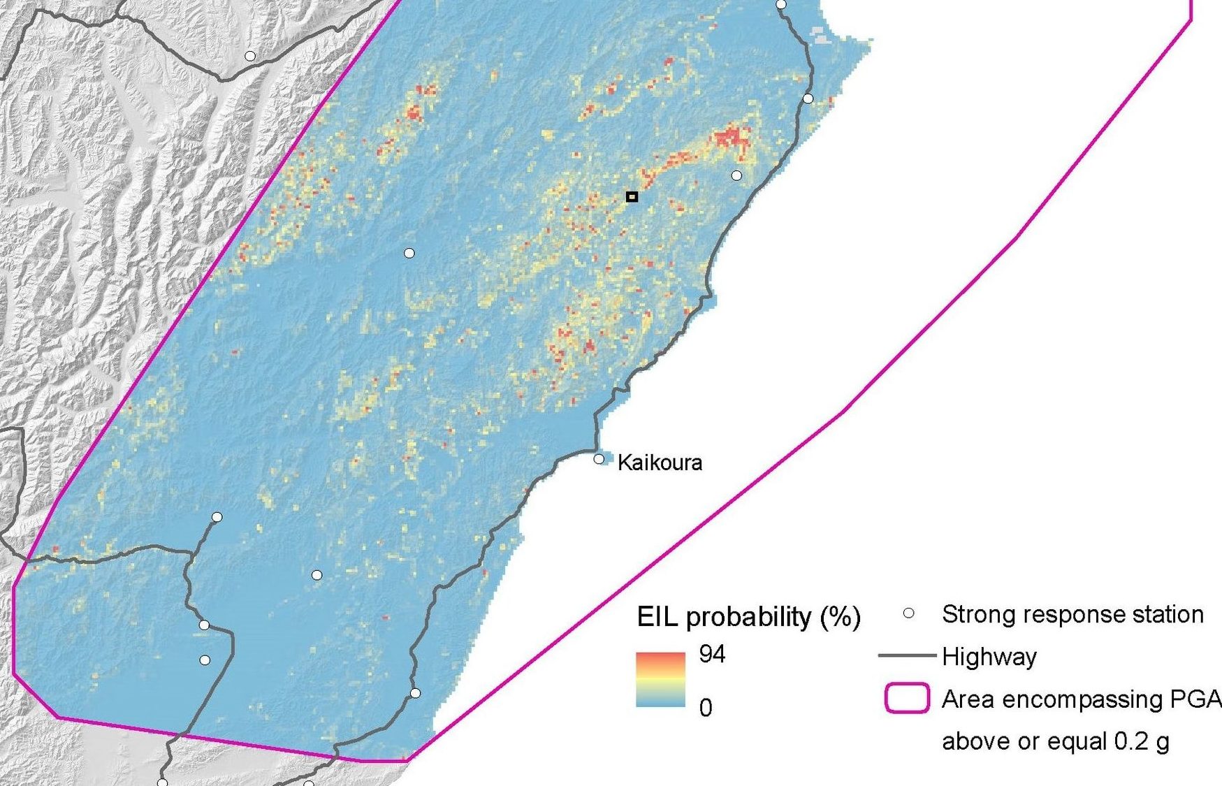
The tool is operational within the National Geohazard Monitoring Centre of GeoNet and will take measured earthquake ground accelerations and generate a map depicting the probability of a landslide having occurred. The tool will be activated when peak ground accelerations of > 0.2g are recorded. These products will be pushed out as a rapid advisory to infrastructure managers, emergency managers, major landowners and insurers, to guide to post-earthquake reconnaissance. They could also be used in earthquake event scenarios and land-use planning.
The tool uses data from three historical earthquakes; the 2016 Kaikōura earthquake, the 1969 Inangahua earthquake and the 1929 Murchison earthquake and deep learning statistical methods to train the model. The methods and datasets used in the process are described in the 2021 science report (version 2.0) which can be downloaded here from the GNS Science Online Shop at no cost, with a (2023) addendum available here - version 2.1
From the analyses, the probability of a landslide occurring for different return periods of earthquake shaking (100-, 250-, 500- and 1000- year) have been generated and these layers are displayed on the Web Map. The probability grids are displayed using the Standard Deviation (n=2) stretch. These maps can be downloaded as GeoTIFFs using the link below (2.3 Gb zipped data package containing metadata and a layer file).
Massey CI, Lukovic B, Huso R, Buxton R, Potter SH. 2021. Earthquake-induced landslide forecast tool for New Zealand: version 2.0. Lower Hutt (NZ): GNS Science. 77 p. (GNS Science report; 2018/08). doi:10.21420/G2TP9V.
V2.1 see Massey, C.I.; Lukovic, B. 2023 Earthquake-induced landslide forecast tool for New Zealand: Version 2.1. Lower Hutt, N.Z.: GNS Science. GNS Science report 2023/04.; https://doi.org/10.21420/1ZXA-AB51
Head Office
1 Fairway Drive,
Avalon 5010
PO Box 30-368,
Lower Hutt 5040
New Zealand