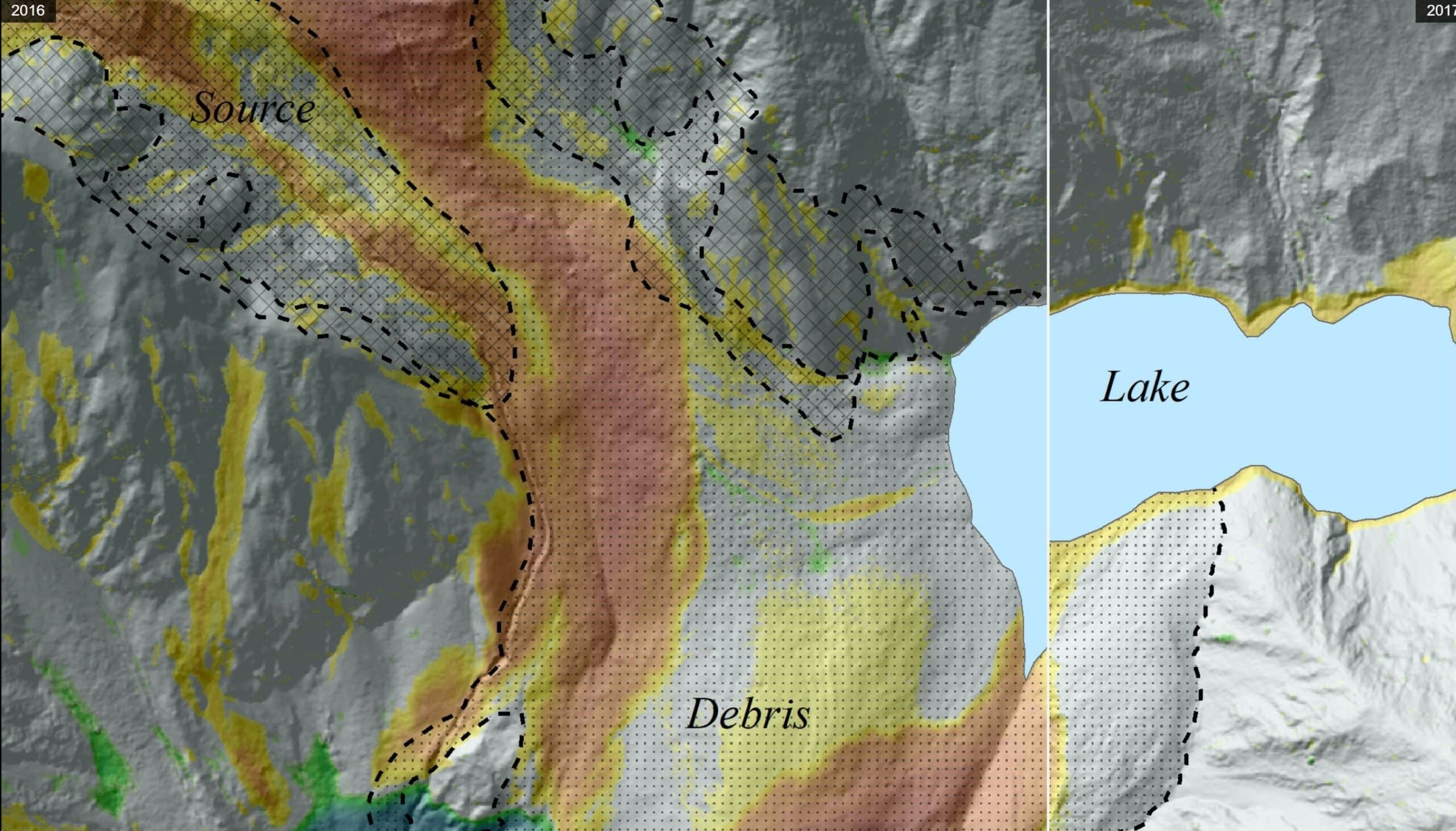
Surface change models of the Hapuku landslide dam have been generated using Light Detection And Ranging (LiDAR) surveys between 2016-2017, 2017-2018 and 2018-2019. The colours in the two epoch pairs shown below depict areas of erosion (reds to yellows) and deposition (greens to blues). Changes between the surveys can be seen using the slider in the middle of the images.
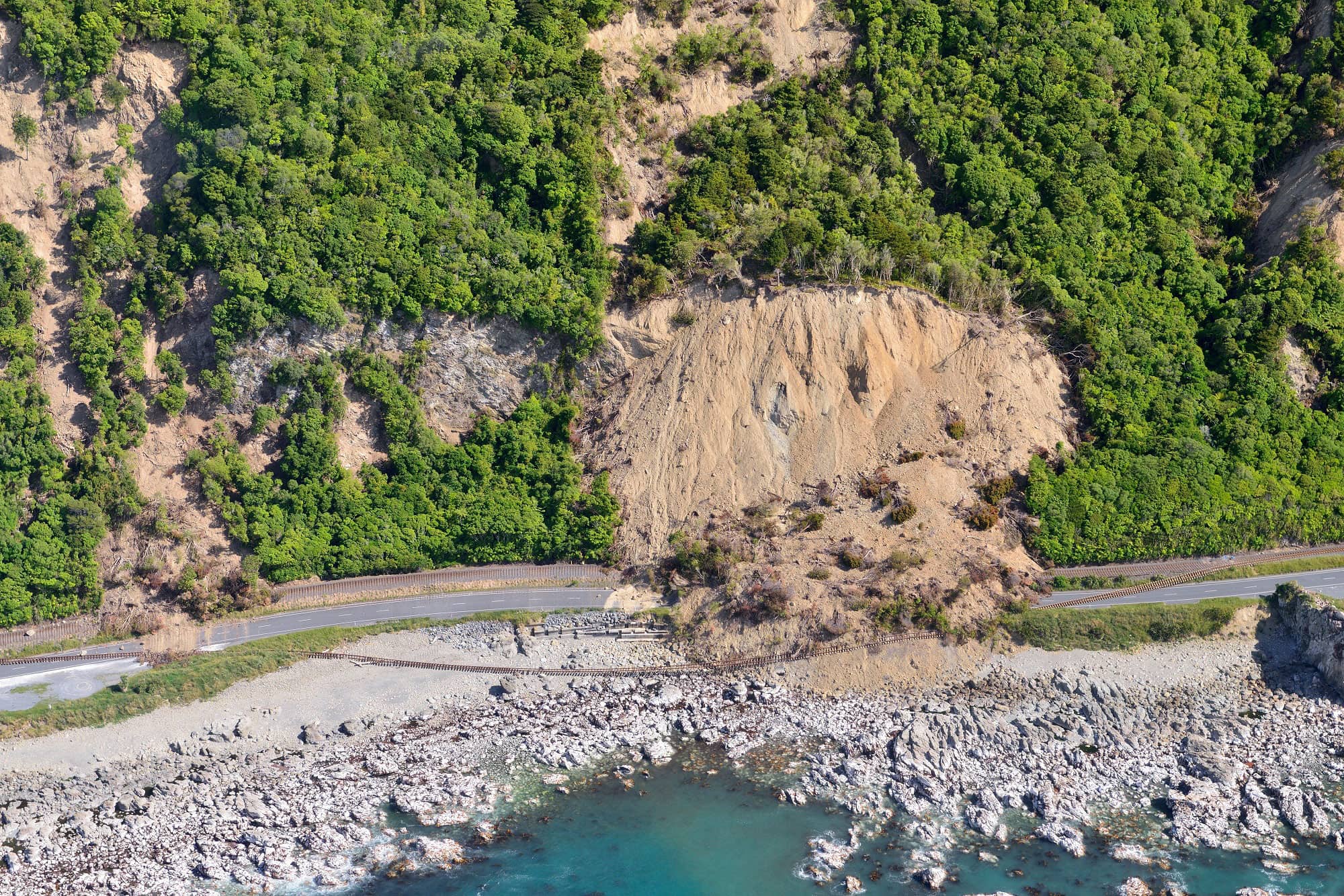
A large amount of change occurred in the Hapuku landslide dam after it was deposited in 2016 (post-earthquake) and 2017. Headward erosion resulted in the loss of a large amount of material from the lower dam (see reds and oranges below the lake), and it partially breached after the intense rainfall associated with cyclones Debbie (23 Mar to 7 Apr 2017) and Cook (14 Apr 2017), which partially drained the lake and reduced its size. This material was deposited downstream in the riverbed (blues and greens). A deep gully was also incised, draining from the source in the north, which further contributed to the large volume of material deposited in the riverbed. Further downstream, an erosional scallop was removed from an old landslide deposit where the river bottlenecks around a tight bend.
There was relatively little change in the dam and lake between 2017-2018, with just some material slumping off the steep, exposed face left by the headward erosion. The deep gully draining the source in the north continued to be incised and eroded. The water flowing down this gully continued to deposit material in the riverbed below (see greens and blues of the higher terrace) before it began incising a narrower channel back down into this material (oranges and yellows).
Another large failure of the dam occurred between 2018-2019. This removal of material closer to the lake resulted in it draining and reducing in size considerably. The gully draining the source continued to deepen and widen, and this material was deposited on the downstream riverbed, infilling the channel that had started to be cut down into this material in the previous model. This channel incision then jumped towards the right as the active channel migrates east. Downstream, the river continued to scallop back the deposit left from an old landslide, as it cuts its way into the toe of this debris.
Head Office
1 Fairway Drive,
Avalon 5010
PO Box 30-368,
Lower Hutt 5040
New Zealand