By Katie Jones, PhD Student in Theme 5: Post-earthquake sediment cascades
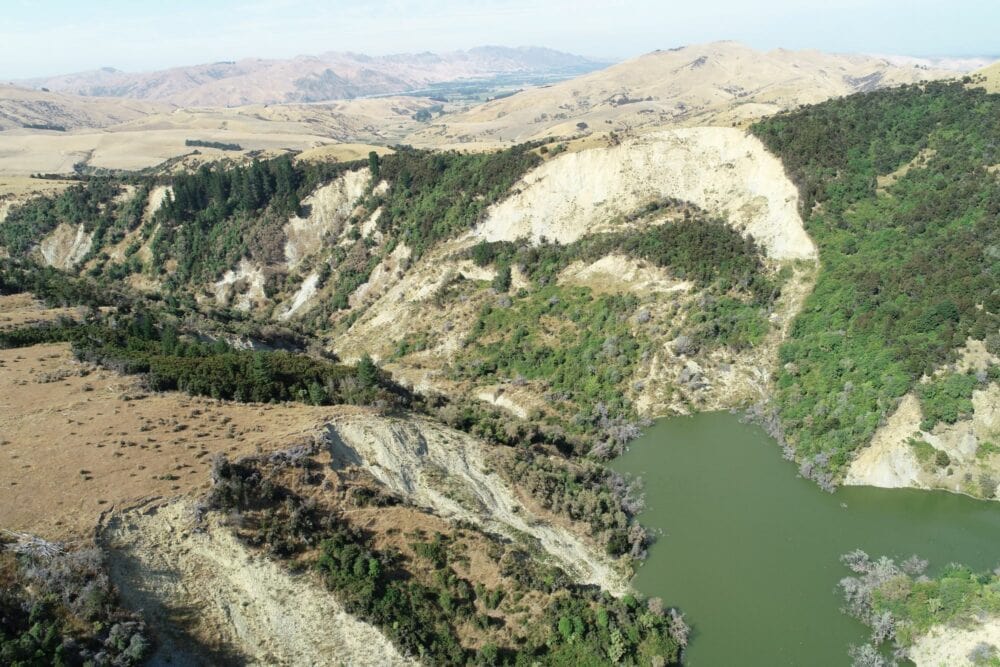
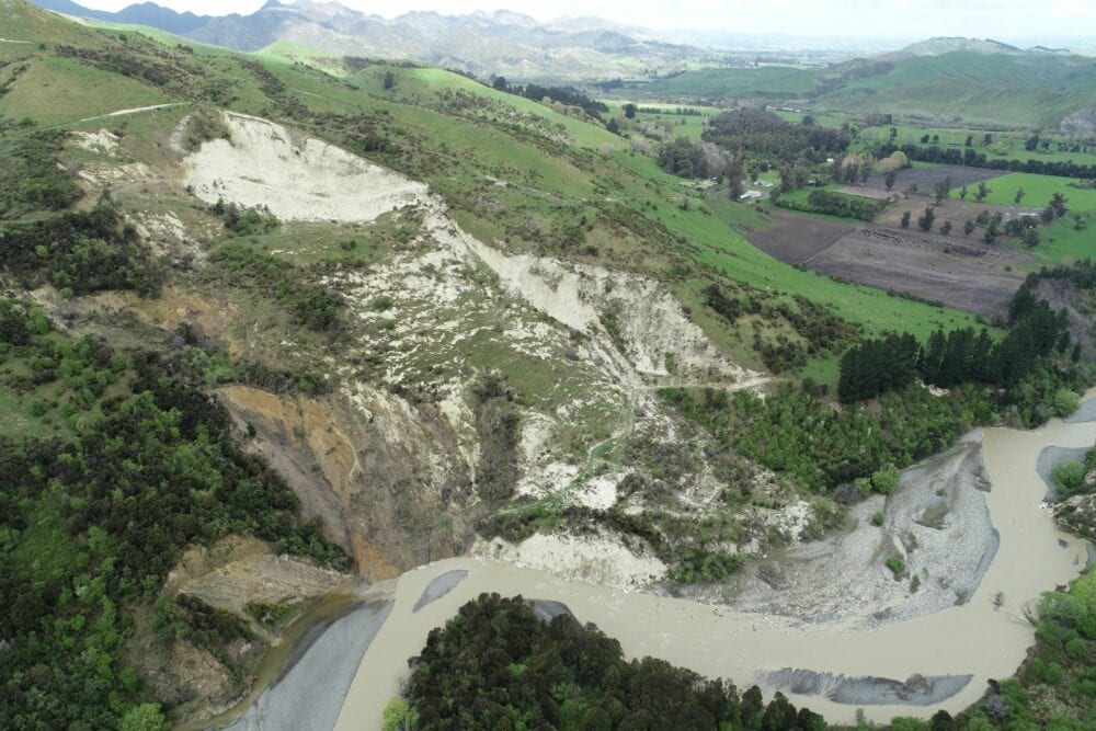
Together with Chris Massey and Regine Morgenstern, along with fellow PhD students Caleb Gasston and Colin Bloom, we spent 2 weeks in the field during October 2019 and January 2020 visiting a selection of large landslides triggered by the Mw 7.8 Kaikōura earthquake. Unsurprisingly for northern Canterbury in January, it was hot and dry! That said, many of the landslides dammed adjacent streams and have created new lakes which persist in the landscape 2 years after the earthquake.
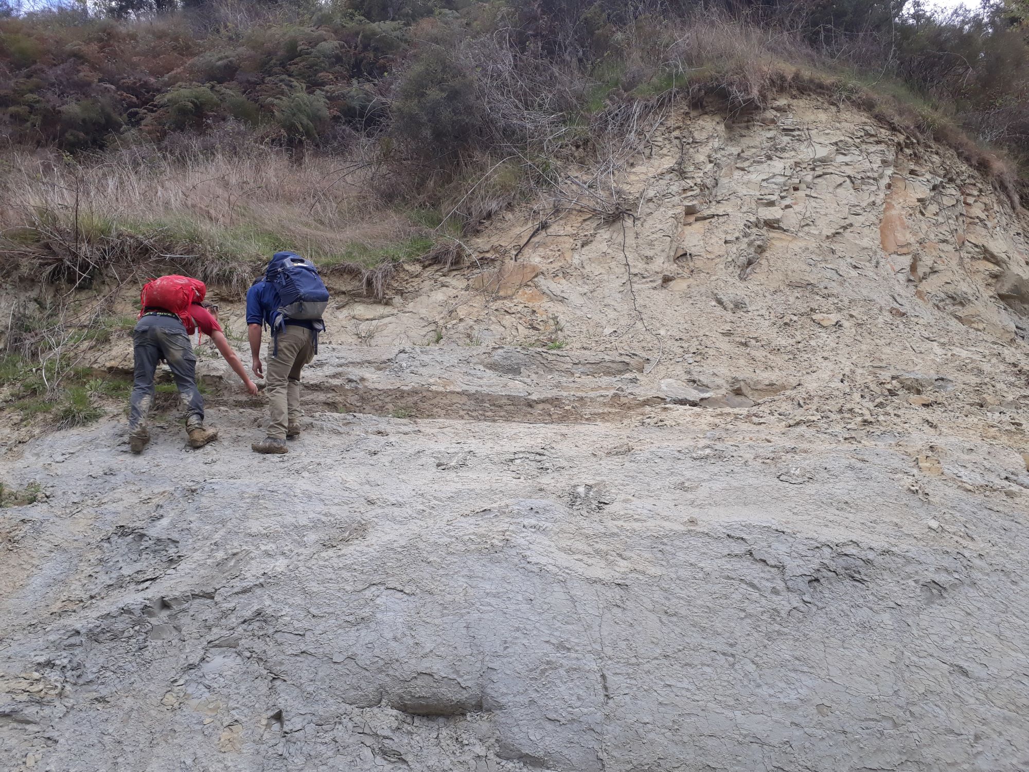
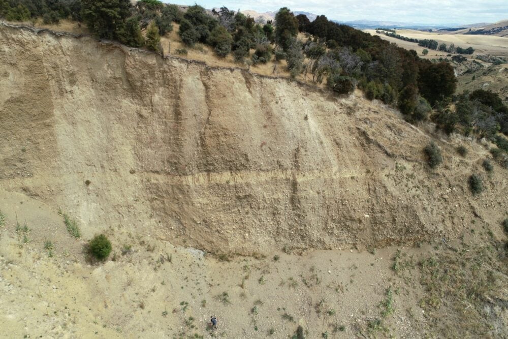
The fieldwork for my PhD project involves looking at the local geological controls of large co-seismic landslides. My aim is to estimate landslide volume and to do this I need to classify landslide type and understand what is controlling the depth to failure. While the landslides were mapped from aerial photography, there is only so much we can see without having boots on the ground.
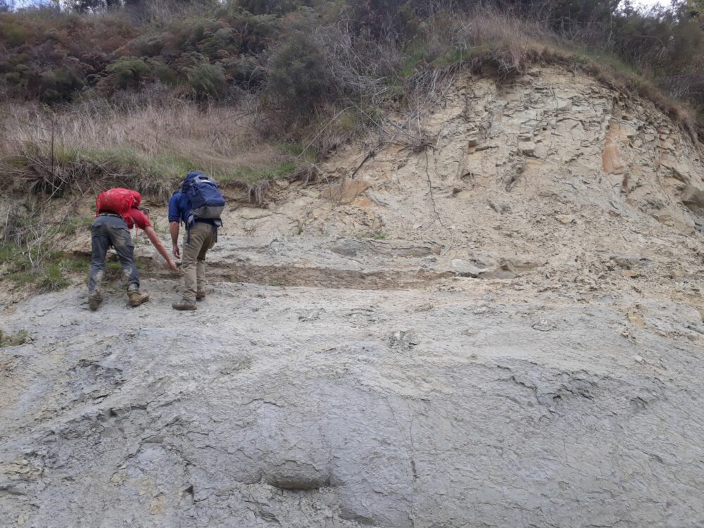
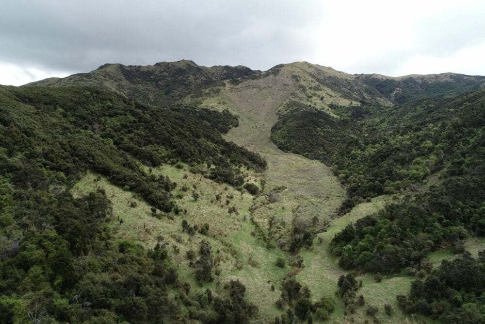
We surveyed each landslide with the UAV and walked up and down the hillsides mapping landslide features. We took structural measurements of rock outcrops looking for bedding and joints to compare with the direction of landslide movement. Walking over the surface of the landslide we mapped cracks in the ground and zones of displaced debris representing how far the rock had broken down and travelled downslope. Many of the landslide surfaces have started to revegetate within the 2 years since the Kaikōura earthquake.
Combining the remote observations from aerial and UAV photos with local measurements starts to build up an understanding of each landslide. Is the landslide failure surface at depth likely to be along bedding, a persistent joint or deformity in the rock? How do these local controls vary from landslide to landslide? How does lithology influence the size and morphology of the landslide observed?
The UAV surveys create a digital record of the landslide and allow us to compare surveys over time to identify changes in the landslide. Are landslide processes continuing to supply sediment to the local streams and rivers in the years following the 2016 earthquake? How far downstream can we track these sediment pulses?
The highlight of this fieldwork was to see the scale of these landslides and stand in awe at the force of the earthquake rupturing the earth’s surface. I am grateful to the local landowners who allowed us access to their land and who shared their experiences of the 2016 Kaikoura earthquake. Kia ora koutou.
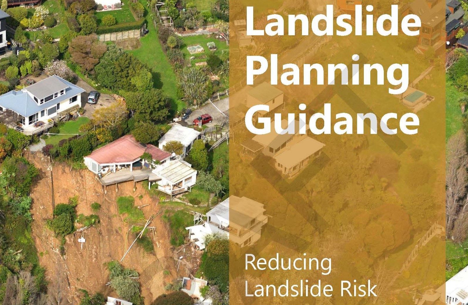
Head Office
1 Fairway Drive,
Avalon 5010
PO Box 30-368,
Lower Hutt 5040
New Zealand