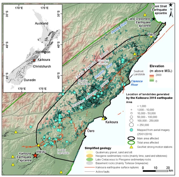
The latest version (2.0) of the landslide inventory for the 2016 Kaikoura earthquake is available here from the DesignSafe-CI website here.
The Version 2.0 inventory contains nearly 30,000 landslides. The data contains all landslides from Version 1.0, plus additional landslides mapped from the high-resolution aerial photographs. The Version 2.0 inventory is published as points that represent the centroids of the mapped landslide source area. Version 2.0 data is available in both CSV format and in GIS Shapefile format, projected in the NZGD 2000 New Zealand Transverse Mercator coordinate system. You can also view the data in the webmap
The reference is:
Massey, C. Townsend, D. Rosser, B. Morgenstern, R. Jones, K. Lukovic, B. Davidson, J. (2021) "Version 2.0 of the landslide inventory for the Mw 7.8 14 November 2016, Kaikōura Earthquake", in V2.0 Landslide inventory for the Mw7.8 14 November 2016, Kaikōura Earthquake, New Zealand. DesignSafe-CI.
Our plan is to eventually publish a Version 3.0 inventory, which will contain the landslide source and debris polygons, along with other landslide attributes such as volume. Watch this space.
Head Office
1 Fairway Drive,
Avalon 5010
PO Box 30-368,
Lower Hutt 5040
New Zealand